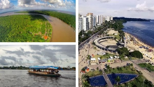
The cities of the Amazon River seen on a map are organized, from the south center to the north center of the central Amazon, as a kind of arch that has Iquitos , in its lowest part, and which then rises until it reaches Macapá , with its middle part in Manaus .
The Amazon River is the longest and mightiest in the world, with a total length of 7,062 km. A very long journey from its source, in the Apacheta ravine, on the slopes of the Nevado Quehisha, in the department of Arequipa, at 5,170 meters above sea level, in Peru, to its mouth in the Atlantic Ocean, near the city of Macapá, in the Brazil .
The Amazon directly touches Peruvian territory, where it is born, passing through the Amazonian territories of Colombia and Brazil on its way.
Before beginning our journey in different boats through the waters and cities of the Amazon River, it is impossible not to remember the conquerors who made this long journey for the first time in the eyes of the Western world. In a very different time where there were still no cities on its banks, but small villages of indigenous peoples and an immense jungle , mysterious and unknown.
🚀 Start of the journey through the cities of the Amazon River 🚀
There have been two great European expeditions that crossed the Amazon River between the middle of the 16th century and the middle of the 17th century. One was that of the Spanish conqueror Francisco Orellana , between 1541-1542, who set out from Quito, navigating the Coca and Napo rivers, tributaries of the Amazon River .
The other expedition was that of the Portuguese conqueror Pedro de Texeira ninety years later, between 1638 and 1639. Texeira sailed the reverse route to that followed by Orellana.
Our journey begins at the confluence of the Coca with the Napo , now called Puerto Napo, where the river becomes navigable by large barges. We leave the Coca, and we enter the Napo, a mightier river, the largest river in all of Ecuador , with a length of 1,800 km from its source, in the foothills of the Eastern Cordillera of the Andes, to its mouth in the Amazon River.
The Napo runs 700 km in Ecuadorian territory. The rest does so through the Peruvian territory until it merges with the Amazon.
Our journey was not as winding as Orellana’s: the wind hits our faces, the journey is almost endless, contemplating identical landscapes, the torrents are strong and the storms are fearsome, but fortunately the river is not lonely.
There are many canoes, sliders and barges that pass through it. At last, the sun appears and the panorama clears, offering the traveler the beautiful views of the majestic nature and the cities of the Amazon River.
➡️ 1. Iquitos
Following the river from its source, looking for its mouth in the Atlantic Ocean, the first important city that we find is Iquitos, capital of the Loreto region, considered the capital of the Peruvian Amazon .
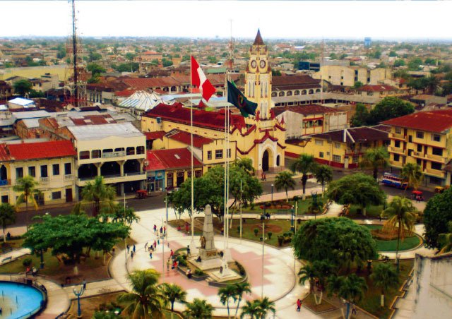
The city has about 480,000 inhabitants. It does not have access by land, but by air and river. It is a kind of island surrounded by water, by the Itaya and Nanay rivers. Nearby runs the Amazon.
Iquitos communicates by land with the city of Nauta , place of confluence of the Ucayali and Marañón rivers, which many consider to be the true source of the Amazon due to the enormous flow of water that these two great rivers provide.
In the city of Iquitos you can find old, dilapidated and luxurious buildings erected at the time of the rubber barons , some of whom had established their residence there.
It has long, modern avenues, a vast Plaza de Armas , a beautiful church, an exotic Casa de Hierro , supposedly designed by Gustave Eiffel, and houses several Amazonian universities and research institutes, some comfortable hotels , a wide gastronomy made with jungle products and an active life of public entertainment and art spaces make it a hotbed of cosmopolitan encounters, where sensuality is in the air.
There it is, on the long boardwalk, there is a beautiful library, the Biblioteca Amazónica , in which I spent months doing research for a book I was writing about regional gastronomy.
From the port of Iquitos, tourist cruises that travel the Amazon continuously depart.
In the city, the Belén market enjoys well-deserved fame, with the hubbub of the Paquito Passage, full of Amazonian fruits , especially palm tree drupes, and meat from wild and aquatic animals, handicrafts and various products such as ointments, perfumes , aphrodisiac drinks , incense and medicinal plants .
The distance between Iquitos to Leticia, following the Amazon, is 371 km., which can only be traveled by river, taking a ferry that takes about eight hours on the way.
➡️ 2. Leticia
The second important city on the route of the Amazon River cities is Leticia , a Colombian Amazonian city, capital of the department of Amazonas, without land communication with the rest of the country. It has about 50,000 inhabitants, and has two parks (one of them is the Santander park , with its many parrots), a spacious cathedral , the ethnographic museum , the Tourist Dock and several branches of national universities and the main headquarters of the University of the Amazon .
Leticia is in the Amazon trapezoid, which corresponds to the tripartite border of Colombia, Brazil and Peru. The city of Leticia is connected to Tabatinga, located in the Brazilian part.
It is enough to cross a small avenue almost 4 km long (International or De Amizade) to be in Tabatinga. Both, twinned, despite their national differences, make up a metropolitan area of just over 100,000 inhabitants.
➡️ 3. Tabatinga
Tabatinga is the capital of the Brazilian municipality of the same name. And it has 61,000 inhabitants, but it is less developed than Leticia, on which, in a certain way, it depends commercially. Tibatinga is a port with few tourist attractions (the Casa del Chocolate , the Mirador de la Comara and a shop specializing in footwear).
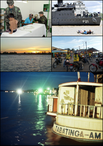
Source: Army in the Estirão do Equador – AM (8904379608) by Jorge Cardoso
Operação Ágata 7 in Tabatinga – AM (8903760639) by Jorge Cardoso
Alto Solimões in Tabatinga by Vitogustavo
Motorcycle taxi of Tabatinga by Goelette.Cardabela
Tabatinga-AM by Acreana. CCby 3.0
Tabatinga is connected to Manaus , some 1,107 km distant, only by air (from the Tabatinga International Airport, a trip of almost two hours) or by river.
River communications are served by two river navigation systems: a fast boat that takes 30 hours, a more expensive service, and a slow boat, cheaper but that lasts at least almost four days, depending on the address: yes going downriver, towards Manaus, it takes a little over three days, and if it goes upriver, on the return trip, it takes about seven days.
➡️ 4. tea
After Tabatinga comes Tefé, a Brazilian river city, municipal capital of Amazonas state, with some 60,000 inhabitants, where people live in floating houses and public transport is river, with voadeiras, which are motor boats with capacity for four to eight people.

Tefé is almost disconnected from the outside world, and is economically dependent on Manaus, which is some 356 km away. In Tefé there is a small local airport , served by an airline, which connects with Manaus in 50 m.
The other connection is by river: by slow ferry, the cheapest option, which takes almost 12 hours to travel, or the fastest and most expensive option, is a fast ferry that takes almost three hours to travel.
➡️ 5. Manaus
In our trip through the cities of the Amazon River follows Manaus, or Manaus in Spanish. With almost 2 million inhabitants, the most populous city-port in the entire Amazon basin , it is the seventh most populous city in Brazil and one of the largest population centers in the world, with more than 210 million people.
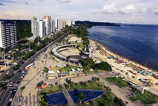
Manaus is the capital of the vast state of Amazonas, which is the most active economic pole and financial center in the northern region of Brazil. A beautiful city that has historic buildings erected during the time of the Amazon rubber boom, in the period 1890-1920, and the growing extraction of walnuts or chestnuts and fine wood from the Amazon forest. Its wonderful constructions from the end of the 19th century and the beginning of the 20th are very celebrated.
Three of them are iconic: the Casa de la Ópera or Teatro Amazonas (opened in 1896, where the Amazon Opera Festival and a Film Festival are held), the Adolpho Lisboa Municipal Market (next to the Negro River, constituting an extraordinary set of iron built in the Art Nouveau style, in 1882, with a varied offer of regional gastronomy, Amazonian fruits and indigenous crafts).
Also noteworthy is the Palacio Río Negro built in 1903 for the family residence, Palacio Scholz, of the German rubber businessman, Waldemar Scholz. In 1918 it was acquired by the Government of the state of Amazonas, to be converted into the state government house. As of 1995, it became a cultural center and a museum from the era of the rubber boom in the Amazon.
Manaus is also a modern city, with many shopping malls and modern buildings. One of the most visited constructions is the cable-stayed bridge over the Negro River and the Museum of the Amazon , made up of 100 ha of forest reserve, created in 2009 and which functions as an open museum that shows part of the enormous diversity of Amazonian nature. .
An unmissable show when visiting Manaus is the one offered by the “Meeting of the waters ”, the point where the dark waters of the Negro River meet and the lighter waters, although brownish, of the Solimoes River, the name given in Brazil to the upper reaches of the Amazon River.
➡️ 6. Itacoatiara
From Manaus you go to Itacoatiara, the third most populous city in the Amazonas state, with 101,000 inhabitants, located at a distance of 270 km by river from Manaus.

➡️ 7. Parintins
Next comes Parintins, a city, capital of the municipality, with the largest population, with 108,250 inhabitants, the second most populous city in the state of Amazonas, located 228 km from Manaus.

Famous in the country because it is the venue for the celebration, at the end of June of each year, of the Parintins Folklore Festival, which takes place in the Bumbódromo , under the open sky, with a capacity for 35,000 spectators.
➡️ 8. Obidos
Óbidos follows, a city located in the state of Pará, with 50,000 inhabitants, located at the point where the course of the Amazon River is the narrowest and fastest in its entire trajectory, with only 1.7 km wide.

From Óbidos you go by ferry to Santarém, about 107 km away, a journey that takes 3 hours to travel.
➡️ 9. Santarem
Santarém is a municipality in the Brazilian state of Pará, with 206,000 inhabitants. Located at the confluence of the Tapajós and Amazon rivers. It is one of the most touristic cities of the Amazon River in Brazil. Tapajoense ceramics are produced there, of the highest quality, comparable even to fine Chinese porcelain.
The city has many attractions: the Joao Fona Cultural Center , the Dica Fraçao Museum , the Museum of Sacred Art , the cathedral of Our Lady of Conceicao , the Border of Santarém , the Vera Paz forest , the park City Park , the Maracana beach , and the famous spa Alter-do-Chao , 30 km from the city, with its Green Lake and the Island of Love.
➡️ 10. Almeirim
Next is the city of Almeirim, with 34,000 inhabitants, a municipality in the state of Pará, in the northern part of Brazil, bordering Suriname.
The distance between Santarém and Almeirim is barely 6 km, which takes about 9 minutes by car.
In that area there is a colonial fortress built by the Portuguese to defend the Amazon River. Almeirim is the second center of buffalo milk and cheese production in Brazil.
➡️ 11. Macapa
The last important city located on the banks of the Amazon River, before reaching its mouth in the Atlantic, is Macapá, capital of the Brazilian state of Amapá, northeast of the state of Pará, with a population of 470,000 inhabitants, characterized by the presence of a strong influence of black culture.

That influence is evident in the regional gastronomy, in the practice of the marabaixo dance , to the rhythm of drums, and in the conservation of the almost intact cultural relic of the black community of Quilimbola del Curiaú.
Macapá also has two facts that characterize it. The first is that it is the only Amazonian capital that is not connected by land with other capitals in the country, and has to do so by river or air.
The second is that the line of Ecuador passes through the southern part of the state. That is why they call Macapá the capital of the Middle of the World, which is remembered with the Marco Cero Complex , made up of a tall monument, a large soccer stadium and the Sambadrome for the exhibition of the Carnival Festival dances.

Above Right: Fortress of São José de Macapá.
Center Left: View of the center of Macapá.jpg
Center Right: Equator Line Monument in Macapa AP, Brazil
Bottom Left: Trapiche Eliezer Levi.
Source: Montage by Myara K. / CC BY-SA
➡️ Mouth
The Amazon River then widens, preparing itself, dragging sediments, for the mouth, until it reaches about 330 km wide, between Cabo do Norte and Punto Patijca, which includes the huge island of Marajó .
Here ends our long journey through the cities of the Amazon River, it has been an exciting journey full of many anecdotes that we avoid adding in this article so as not to make it too long. The ending brings a thunderous noise like continuous applause, let’s see what it is about.
The Amazon River advances towards its final destination, at a speed of up to 25 km per hour, accompanied by an enormous roar, a phenomenon known as pororoca . And the river goes into the sea, with its gigantic volume of water and sediment, with such a force that the water feels sweet almost up to 160 km offshore.
Related Posts
March 16, 2020
Tourist attractions of the Venezuelan Amazon Rainforest
November 4, 2019
Tourist Attractions in the Amazon Rainforest
October 24, 2019
10 tourist attractions of the Brazilian Amazon rainforest
October 24, 2019

10 tourist attractions of the Bolivian Amazon Rainforest
October 24, 2019
Peruvian Amazon Rainforest Tourist attractions
October 24, 2019
Tourist attractions of the Ecuadorian Amazon Rainforest
October 19, 2019
Places for fishing in the Amazon River Basin: the cocha and the lagoons
May 3, 2022
Manaus: a gastronomic and cultural experience
December 29, 2020
Aguaytía
December 26, 2020
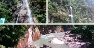
The Father Abad Canyon (SPN: Boquerón del Padre Abad)
December 24, 2020
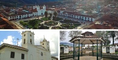
Chachapoyas
December 22, 2020
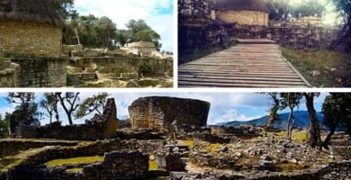
Kuelap Fortress
December 19, 2020
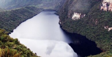
Laguna de las momias (lagoon of the mummies)
December 17, 2020
Yarinacocha Lagoon
December 15, 2020

Pitaya petroglyphs
December 13, 2020
Well of Yanayacu
This post is also available in:
![]() Español (Spanish)
Español (Spanish)


